


The natural environment
- The lie of the land
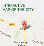
The Zelów Commune is situated on the point of junction of the Łask Height, the Bełchatów Plain and the Szczerców Valley. The Ostoja village, located in the eastern part of the commune, is the highest region (213m above the sea level), whereas the valley of the Chrząstawka village in the south west of the commune is the lowest region (155m above the sea level).
Most of the commune is characterized by flatlands with wide valleys with long, gentle hill-sides and flat bottoms. The landscape is varied by sand dunes in the valleys of such rivers as Pilsia, Chrząstawka, Kiełbaska and Grabia, whose depth may reach up to 15 metres.
- Reservoirs and rivers
The Zelów Commune is entirely located in the basin of the Widawka River and is drained through its inflows: Grabia, Pilsia, Chrząstawka and their inflows. The Grabia flows through the north-west edge of the commune and the administrative border is based on it. The Pilsia flows out on the outskirts of Zelów, in the Drużbice commune. It flows to Bujny through its wide, flat parallel valley. The bed of the river is narrow and regulated. Out of Bujny the river turns south- west. In the region there is a retaining reservoir "Patyki" (area: 5.5 ha). The Chrząstawka River flows out in the region of the village Ignaców and just near the border with the former the Sieradz voivodeship it takes its biggest inflow the Kiełbaska River which flows along the western border of the commune.